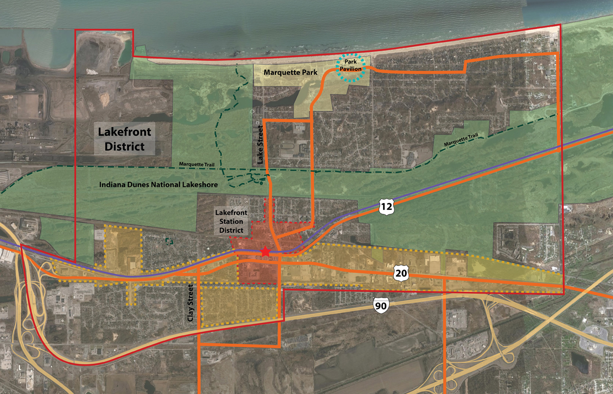
The U.S. Environmental Protection Agency‚ (EPA) Office of Brownfields and Land Revitalization (OBLR) is supporting the Gary, Indiana Lakefront District Revitalization Plan Implementation as part of the Strong Cities/Strong Communities project.
This project was initiated by the impending modernization of the Miller Train Station, which is viewed as a catalyst for the revitalization of this portion of Gary. This current work follows earlier studies that engaged local residents, businesses, landholders, elected officials, the National Park Service, and other stakeholders in an effort to define a community vision on potential future uses for properties in the Lakefront Development District.
The previous work resulted in the development of the Lakefront Development District Community Revitalization Plan that was completed in 2015. The current work will build on this plan and the community outreach work to generate a more refined vision for redevelopment along the Route 20 Corridor. The goal is to create a district that promotes pedestrian movement through traffic calming measures and by
introducing new routes between the train station and the adjoining residential communities on both sides of Route 20. This will include strategies on how to reconfigure major thoroughfares to safely accommodate bicycles and pedestrians in addition to vehicles. The preferred design and development strategies will be translated into zoning and streetscape recommendations that are to be incorporated into the City of Gary’s Comprehensive Plan.
This work will be carried out by the EMS / Vita Nuova Team under contract to OBLR. In addition, the National Development Council (NDC) will provide feasibility and financial analysis to the proposed development. ![]()
The redevelopment constituted under the Gary, Indiana Lakefront District Revitalization Plan Implementation includes four major steps:
- Route 12 Realignment
- Track Realignment
- Complete Streets Implementation
- Creation of a Light Industrial District
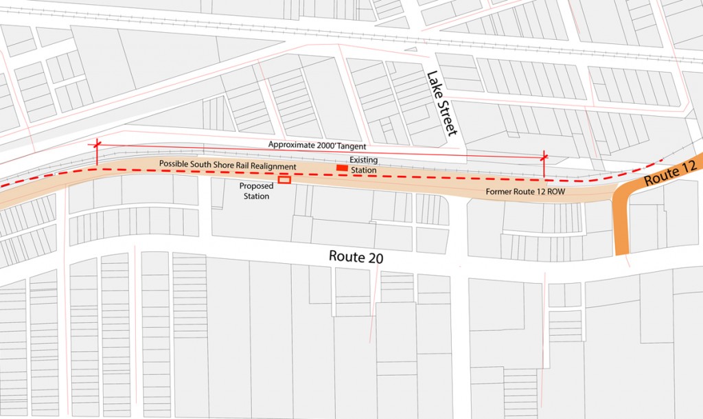
Route 12 Realignment
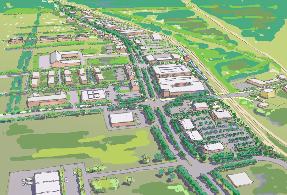
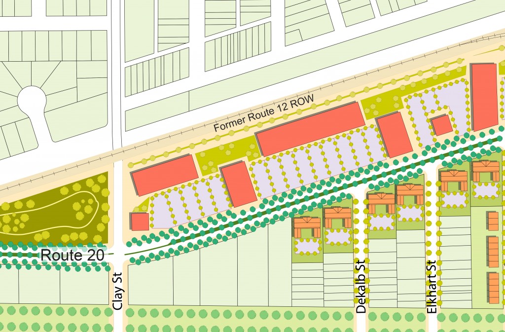
Route 12 and Route 20 run parallel for approximately 1 mile – from a point east of Lake Street to a point west of Clay Street, where the two roadways converge. The land between these two roadways is either vacant or commercial in nature, with driveways and parking lots connecting both arterials at various points. Closing Route 12 along this 1 mile stretch provides a unique opportunity for pedestrian-scale development by creating an atmosphere for attractive commercial development along Route 20 and surrounding the Lake Street Train Station, as well as enhancing connections to residential neighborhood areas to the south of Route 20.
Track Realignment
Closing Route 12 from a point east of Lake Street to the Route 12/20 convergence also creates an opportunity to realign the existing commuter rails to provide a longer tangent track, while keeping the train station in its current location. The proposed realignment may allow for a 750 foot elevated station platform and approximately 2,000 feet of tangent track.
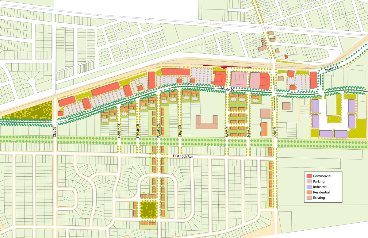
Complete Streets Implementation
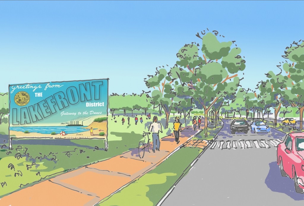
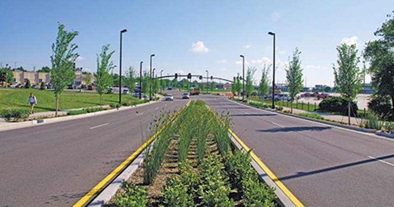
As the gateway to, and heart of, the Lakefront TOD, Route 20 should be upgraded to facilitate the creation of a complete street corridor. These improvements will encourage alternate modes of transportation and, more importantly, facilitate north-south connections allowing easy pedestrian and bicycle access to the train station and residential areas.
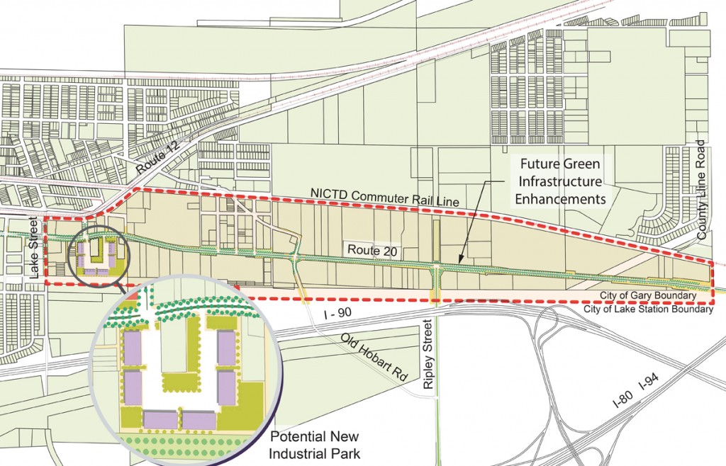
Creation of Light Industrial District
The Light Industrial District (LID) is situated at the far southeast corner of the Lakefront District and acts as a major gateway to the City of Gary and the Lakefront District. In order to facilitate the industrial, residential, and commercial growth the City and Lakefront District both need and seek, below is a list of five specific actions.
- Action 1: Formally Designate the LID as a PILOT Project and Develop a Model Industrial Project on Existing City-Owned Land that Reflects Suggested New Design and Performance Standards for the LID
- Action 2: Formalize a Task Force for the LID Composed of Invested Parties
- Action 3: Establish a Property-Owners and Business Partnership for the LID that Serves as a United Advocacy Voice to Promote the Area
- Action 4: Assemble Properties in the LID to Create Large-Scale Sites that Can Attract and Support Development
- Action 5: Complete a Development Project as Part of a Proof of Concept for LID Pilot